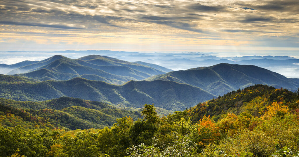
The Blue Ridge Mountains are one of three parts within the Appalachian Mountains and stretch from Georgia to Pennsylvania. The mountains began forming 400 million years ago during the Silurian Period due to North America and Europe colliding.To the east is the Blue Ridge Escarpment, a steep uplift in earthen material forming the slope of the mountains, and to the west is the Valley and Ridge portion of the Appalachian Mountains. These mountains were once some of the tallest in the world and are still home to the tallest east of the Mississippi with Mt. Mitchell reaching 6,684 ft.
Formation of the Blue Ridge
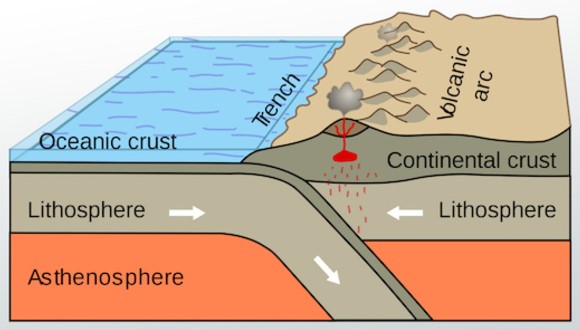
Many mountain ranges are formed by the collision of tectonic plates. The compression of land that occurs as a result forces land upward creating the range. While this is the same basic process that created the Appalachian Mountains, there were some other complex aspects involved. Between the two continents colliding was an ocean filled with multiple island chains. These island chains were formed by subduction zones, areas where one plate goes beneath the other. The plate then melts and rises to the surface creating volcanoes. When this happens in the middle of the ocean we are left with island chains like Japan.
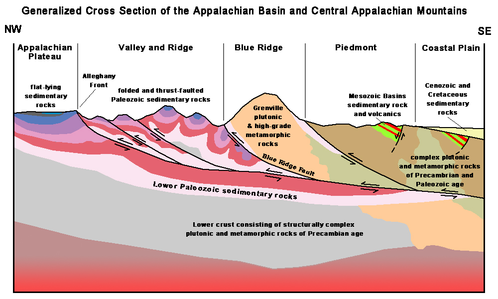
As the two continents began to drift towards each other, the volcanic island chains became trapped in between. Also between the continents were other “micro continents” which were not formed by subduction. This meant there was far more earthen material between the two continents leading to even more uplift. The resulting mountain range not only reached towering heights because of the excess material, but it also had distinct features throughout the range of the normal uplift, the islands chains, and the microcontinents involved.
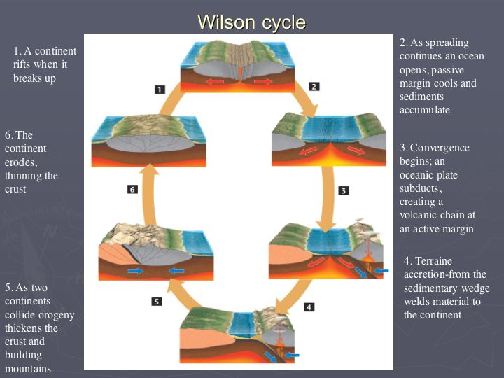
This process of tectonic plates colliding, and later diverging, is called the Wilson Cycle. It is a continuing process that has been happening for eons and will continue to shape the face of the Earth for eons.
Stream Capture in the Blue Ridge
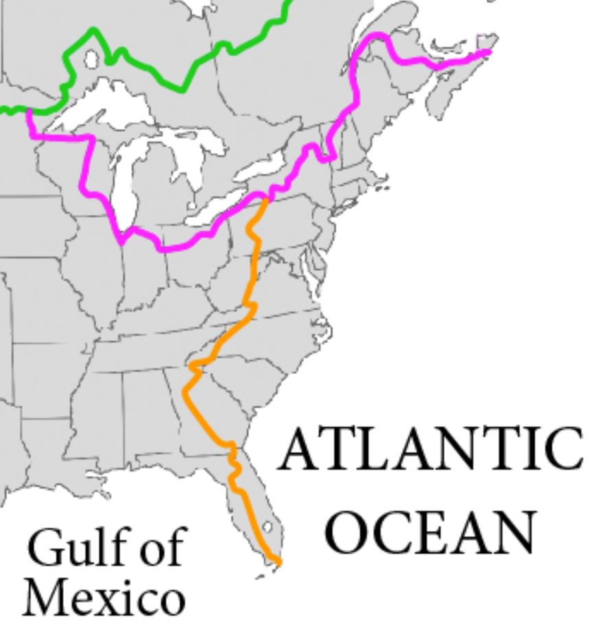
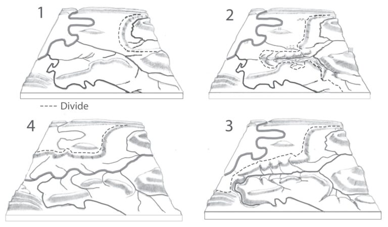
Stream capture, river capture, river piracy or stream piracy is a geomorphological phenomenon occurring when a stream or river drainage system or watershed is diverted from its own bed, and flows instead down the bed of a neighboring stream.The Blue Ridge Escarpment (BRE) is home to a large portion of the Eastern Continental Divide (ECD) where streams on the east flow into the Atlantic and streams to the west flow into the Gulf of Mexico. This divide is slowly moving as stream capture and headward erosion moves streams farther up the escarpment.
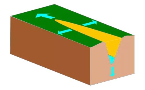
Diagram of Headward Erosion
Headward erosion is the lengthening of stream channels due to erosion at the origin. As headward erosion moves the origins of streams up the BRE, stream capture is likely to happen. When a small stream has enough headward erosion to reach a larger river on the other side of the ECD, the drainage basin is diverted into the smaller steam and changes the location of the ECD.
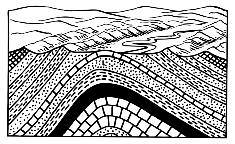
Anticlines and Synclines
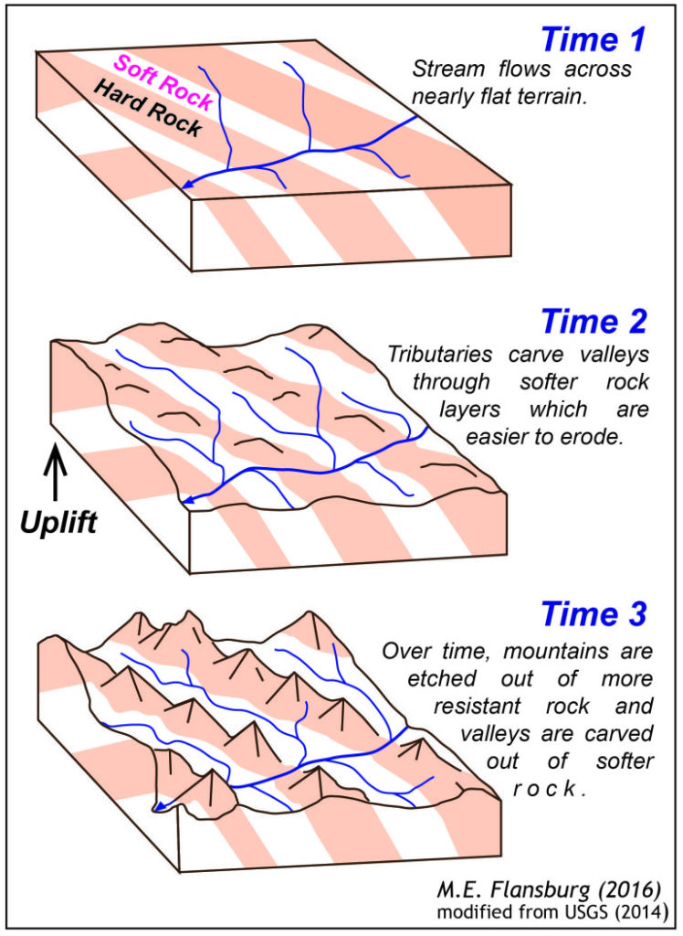
When tectonic plates collide, the crusts compress and squish together in a way that results in bedrock that looks wavy. In these wave patterns formed, the top of the “wave” is an anticline, and the dip is a syncline. The alternating material caused by the compression of earth will eventually begin to erode but at different rates. Harder material will be more difficult to erode and thus will remain in place while softer materials will be carved more quickly. This can form small valleys where the soft material has been eroded and peaks where the tougher material remains.
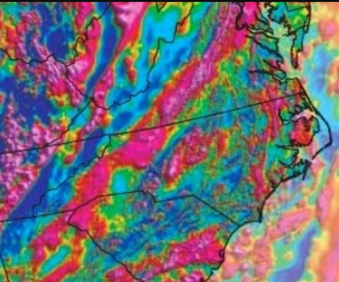
Gravity Anomalies
The red streak along the Blue Ridge is indicative of gravity anomalies.
Gravity anomalies are areas that have a higher gravitational pull. This can be caused by earthen material of different densities, either lighter or heavier, or by the sheer size of some mountain ranges. The Himalayas are known for this and have such a strong pull they threw off cartographers and surveyors for years. The Appalachian Mountains also have plenty of gravity anomalies, though not to the same extent. These stretch from Georgia to Pennsylvania and are caused by dense accumulations of material or pockets, both formed during the creation of the mountain range.
Landslides
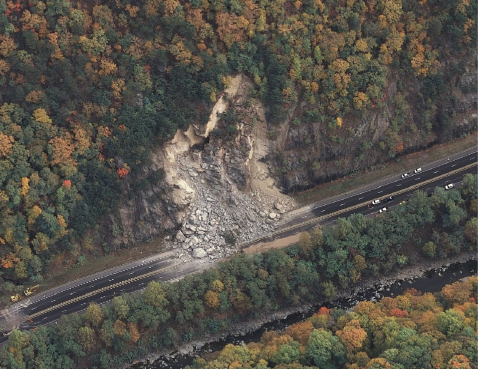
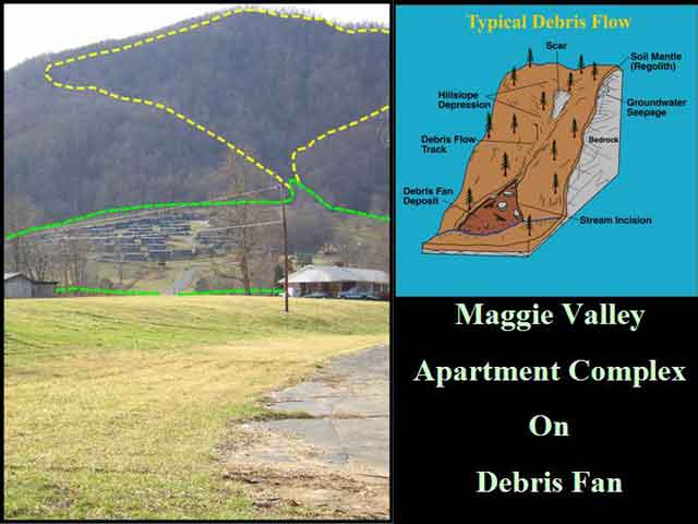
Landslides are on of the most common threats throughout the Blue Ridge due to the steep Blue Ridge Escarpment. This provides high potential energy for rocks, dirt, and other debris situated on mountains and hills. This debris can be easily dislodged by large amounts of rainfall. When the rainfall is greater than the rain being absorbed by the ground, landslides are triggered.
Landslides in North Carolina and the rest of the Blue Ridge are not only dangerous because of their prevalence but also because of development putting people in harms way. Previous risk assessment in North Carolina was halted after only 4 counties were analyzed. In the 4 counties that were able to be observed, each of them showed that landslides were potentially hazardous. Many people live directly in gullies where debris is likely to flow or even on top of piles of past debris. In either case, the dangers of landslides should not be ignored.