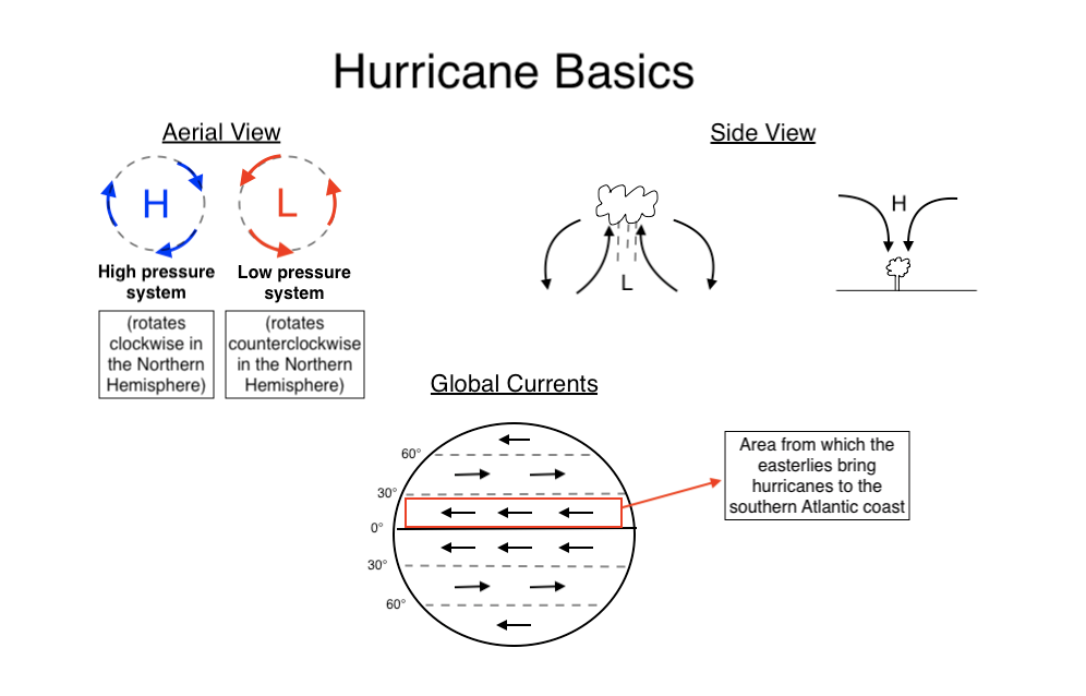
The coast of North Carolina, as well as the Southeastern Atlantic coast as a whole, has experienced its fair share of hurricanes. Here in the Northern Hemisphere hurricanes rotate counterclockwise, and occur when a low pressure system and a high pressure system lock together in one rotation, like grinding gears. Low pressure systems (which rotate counterclockwise) cause moist air to rise and create condensation, which is where all the rain comes from. High pressure systems (which rotate clockwise) are associated with dryness and push air down. Since the Southeastern coast sits in the area 30 degrees above the equator, the winds from coming from the east (known as easterlies) carry from east to west the hurricanes, and their couterclockwise movement helps to accelerate them in the same direction as well. Hurricanes that form in the Atlantic and ride the easterlies can end up anywhere from the Florida Gulf to the Virginia coast. If you’re unlucky enough to live in the pathway of one of these hurricanes, it’s better to be toward the bottom of the storm where wind is coming off the land, as opposed to the top of the storm where the low pressure wind from the ocean is spiraling directly toward you. With all that being said, wind is only one part of the hurricane’s lethal force. Then comes the storm surge.
Source: Gabe Poulos
Storm Surge
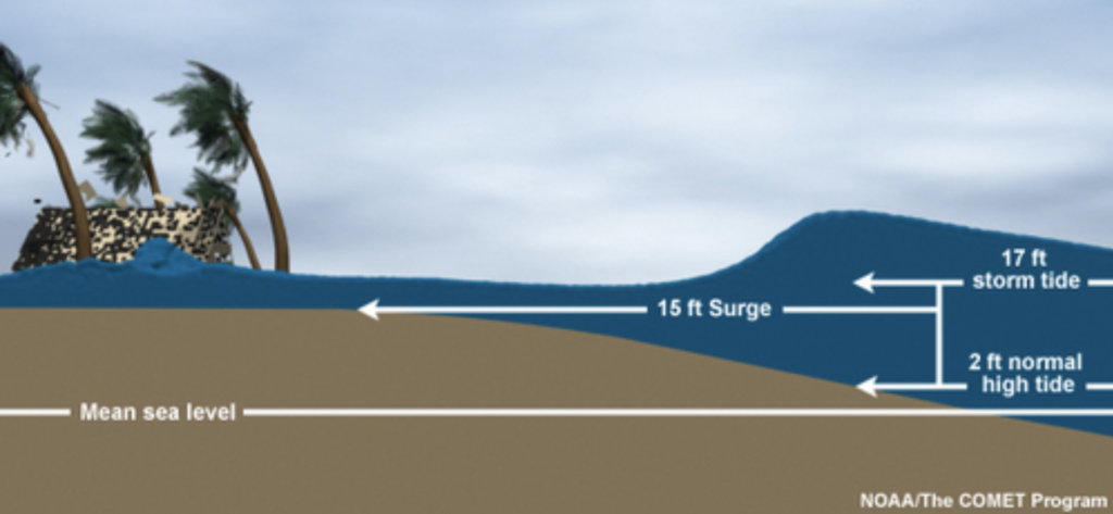
Storm surge is rapid localized sea rise that is associated with low pressure systems and winds; it is typically a product of hurricanes. Since hurricanes are low pressure systems, the relative lack of atmospheric pressure causes a slight dome of water to form in the ocean. The winds push this bulge and pile water up onto the shore, flooding the coast as the storm moves inland. The northeastern side of a hurricane always has the highest storm surge and the strongest winds due to the counterclockwise rotation of the storm.
https://www.nhc.noaa.gov/surge/
Washover Fans
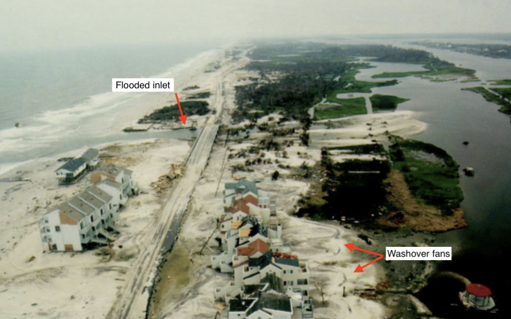
After a storm surge from a hurricane brings massive amounts of water onto the shoreline of barrier islands, it floods the mainland, consuming everything except the sand dunes which are at a higher elevation. The force of the storm surge on the shoreline erodes the sand and carries some of that sediment and deposits it on the back end of the barrier island in a fan-like shape, known as a washover fan (or overwash). Once all of this water forces itself over the barrier island with the energy of the hurricane, getting back to the ocean isn’t as easy. With only gravity to help, the excess water only has a few outlets back to the ocean, which are the narrow spaces between barrier islands. With all his water trying to escape at once, this pressure can cause vulnerable areas on the barrier island to give way to the water and become inlets. Roads are one such vulnerability, and if they are built perpendicular to the shore or run straight through sand dunes, they can quickly turn into a water channel and whatever buildings that are in its way will be ruined. Below is an image from Wilmington after the storm surge from Hurricane Fran (1996) flooded the inland, and is gushing out a small inlet that flows under the roadway. You can see the washover fans in the back yards of the houses to the right side of the road.