An estuary is any area in which a river meets the ocean. Estuaries form in a variety of ways depending on the environmental, geological, and climatic features of a given area. Tectonic activity, coastal elevation, and long-term increases in global temperatures from the Last Glacial Maximum have contributed to estuary formation in North Carolina. The North Carolina Coastal Plain primarily contains three kinds of estuaries: Tributary, Trunk, and Back Barrier Estuaries.
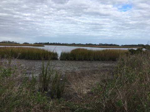
Back-Barrier Estuaries form parallel to the coast between the mainland and barrier islands. They typically have large surface areas and uniform depth, which makes waves and changing tides particularly impactful in back-barrier estuaries. Salinity is also typically uniform in these estuaries.
Trunk estuaries form perpendicular to the coast, when river valleys flood as they approach the ocean. The small number of inlets across North Carolina’s northern estuaries results in high variability of salinity levels. Additionally, storms drive much of the water mixing that takes place in North Carolina’s trunk estuaries.
Tributary estuaries are much smaller estuaries that form on the outside of trunk estuaries, flowing into them. These estuaries are typically made up of mostly freshwater.
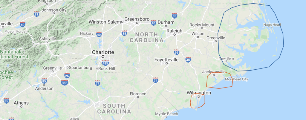
The northern and southern provinces of North Carolina each contain distinct geological differences, many of which play a significant role in how estuaries form in each region. The southern province is made up of older rocks—mostly mudstone, sandstone, and limestone—ranging from 90 mya to 1.6 mya. Minor tectonic activity shifted these older rock formations, initiating shoreline erosion and exposing older rock at the surface. The average slope of the southern province is approximately 3 feet per mile. This higher slope creates narrow back-barrier estuaries with smaller surface area and larger amounts of organic matter, which help better protect estuaries from storms and rising tides.
The northern province is made up of much younger sediment—muds, sands, and peat—deposited over the past 1.6 million years during ice age-induced sea level fluctuations. These sediments have produced much more gentle topography compared to the south, and have resulted in an average slope of only 0.2 feet per mile with a much larger drowned-river estuarine system.
Southern estuaries (circled in red) are much smaller and narrower than northern estuaries (circled in blue) due to their older sediment composition and higher coastal slope.
Consulted Sources:
Pilkey, Orrin H., et al. “North Carolina Estuaries.” The North Carolina Shore and Its Barrier Islands: Restless Ribbons of Sand, by Orrin H. Pilkey, Duke University Press, 1998, pp. 61–86.
NOAA. “Classifying Estuaries: By Geology.” National Ocean Service, National Oceanic and Atmospheric Administration, Department of Commerce, 21 July 2020, oceanservice.noaa.gov/education/tutorial_estuaries/est04_geology.html.