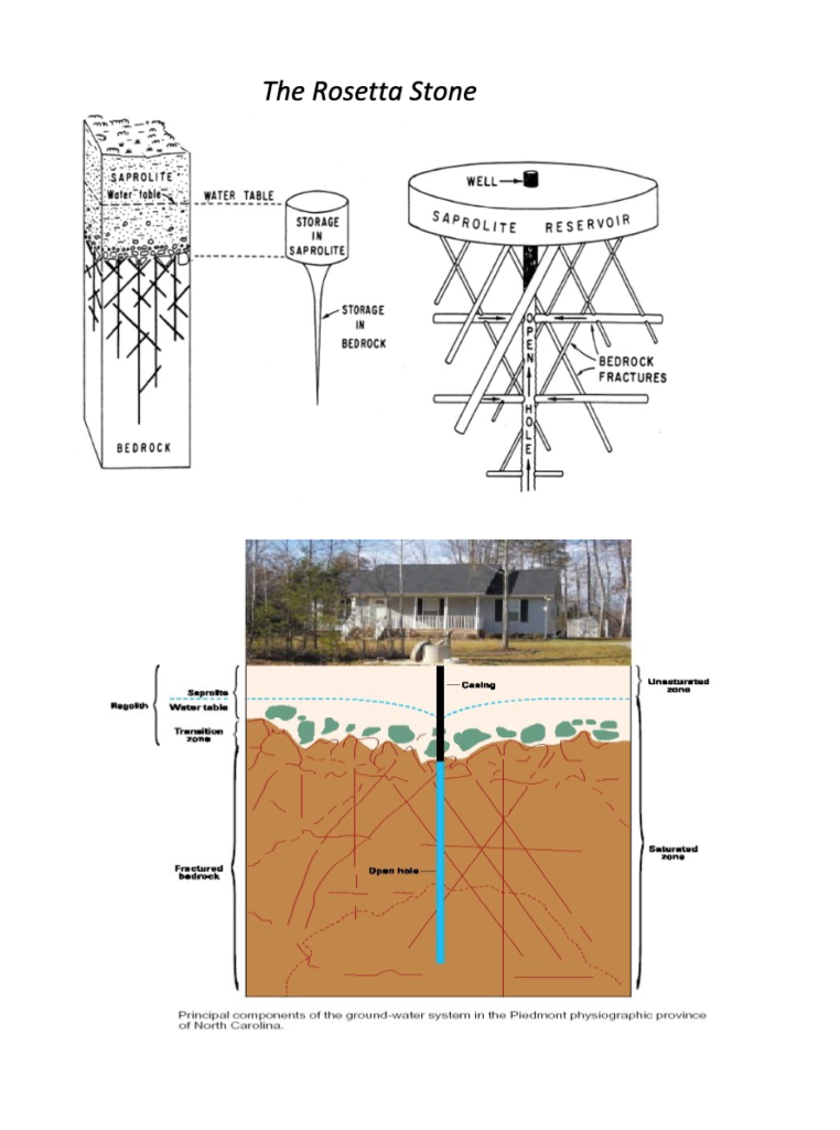
The bedrock in the Piedmont has horizontal cracks, so that the water moves sideways instead of filling up vertical cracks. This means that extracting water from one area in the bedrock could lower a water table hundreds of meters away, instead of directly below the well. Most water is stored in an upper transition layer, between the soil and bedrock, which is composed mostly of saprolite and has high clay content.
A diagram showing the unique soil water storage in the Piedmont, from a study on the Davidson College Lake Campus.
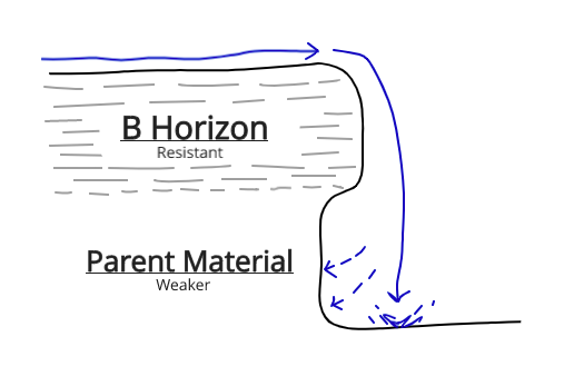
Gullies
One significant characteristic in the Piedmont are gullies. Because there is so little topsoil in the Piedmont due to erosion, the B horizon is close to the surface. The Piedmont B-horizon has a high clay content and is extremely compact. Because of this, it acts almost as an impermeable surface during heavy rain events and redirects runoff into gullies. The runoff, when falling into gullies, erodes the weaker horizons under the B horizon and creates gullies characteristic of the Piedmont.
A diagram showing how gullies are typically formed in the Piedmont.
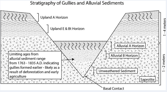
Spell and Johnson dated the alluvial sediment within gullies to trace their time of formation, and found that it happened before the agricultural era.
Many scientists believe that the lack of an A-Horizon in the Piedmont is due to excessive agriculture. However, a study by Spell and Johnson (2019) found that when aging the horizons in alluvial sediment, the ages range from 1763-1835 A.D., meaning that the runoff and erosion that was causing gullies in the area likely happened due to deforestation more than an increase in agricultural land in the Davidson area.